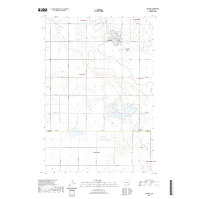
2020 Map of LaMoure
USGS Topo · Published 2020About this map
The town of LaMoure serves as the focal point for this survey, situated at a bend in the James River within the eastern Dakotas. The landscape is characterized by its agricultural grid and significant water bodies, notably Lake LaMoure and the uniquely named Nevermore Lake. For genealogists and local historians, several cemeteries are documented across the rural landscape, including Rosehill Cem near the town center and the Saint Ansgar Lutheran Cem situated near the border of LaMoure Co and Dickey Co. The infrastructure of the area is further defined by the La Moure Rott Municipal Airport and a network of named section roads and city streets that trace the development of this prairie community into the 21st century.
Find a feature on this map
48 named features on this map. Tap any name to fly to it.
Don’t see what you’re looking for? This feature index may not catch every label — zoom into the map to look around manually.
Map Details
Editions of this 2020 LaMoure Map
This is the sole edition of this map. No revisions or reprints were ever made.
Other maps of this area

1894 · La Moure
USGS Topo · 1:62,500

1894 · Fullerton
USGS Topo · 1:62,500

1894 · Oakes
USGS Topo · 1:62,500

1895 · Lamoure
USGS Topo · 1:125,000

1918 · La Moure
USGS Topo · 1:125,000

1952 · Glover
USGS Topo · 1:24,000

1952 · Grand Rapids
USGS Topo · 1:24,000

1952 · Independence
USGS Topo · 1:24,000

1953 · Jamestown
USGS Topo · 1:250,000

1955 · Fullerton NE
USGS Topo · 1:24,000