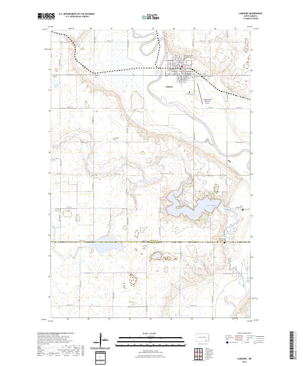
2024 Map of LaMoure
USGS Topo · Published 2024About this map
The James River snakes through the center of this landscape, anchoring the city of LaMoure at the northern edge of the map. As the county seat, the town is oriented around the LaMoure County Courthouse and a detailed grid of streets, including Center Ave E and Main St NW. The surrounding prairie transitions from the river valley into a complex network of wetlands and water bodies, most notably the expansive Lake LaMoure and the smaller Nevermore Lake to its west.
Find a feature on this map
45 named features on this map. Tap any name to fly to it.
Don’t see what you’re looking for? This feature index may not catch every label — zoom into the map to look around manually.
Map Details
Editions of this 2024 LaMoure Map
This is the sole edition of this map. No revisions or reprints were ever made.
Other maps of this area

1894 · La Moure
USGS Topo · 1:62,500

1894 · Fullerton
USGS Topo · 1:62,500

1894 · Oakes
USGS Topo · 1:62,500

1895 · Lamoure
USGS Topo · 1:125,000

1918 · La Moure
USGS Topo · 1:125,000

1952 · Glover
USGS Topo · 1:24,000

1952 · Grand Rapids
USGS Topo · 1:24,000

1952 · Independence
USGS Topo · 1:24,000

1953 · Jamestown
USGS Topo · 1:250,000

1955 · Fullerton NE
USGS Topo · 1:24,000
Featured Places
- LaMoure, ND
- Pearl Lake Township, ND
- Wright Township, ND
- James River Valley Township, ND
- Dean Township, ND