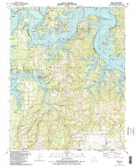
1989 Map of Lampe
USGS Topo · Published 1989About this map
Table Rock Lake dominates the northern reaches of this landscape, its winding shoreline and numerous public use areas marking the modern character of the White River valley in the late 1980s. The terrain transitions from the inundated lakefront to the higher ridges of the Mark Twain National Forest, where smaller settlements like Lampe and Baxter are situated. Genealogical interest is high throughout the southern portion of the sheet near the Missouri Arkansas border, where family-named landmarks and rural burial grounds such as Rhodes Cem and Rice Cem are recorded. The presence of Kimberling Airways Airport and several church camps like Kanahuk-Kanakom Church Camp reflects the area's development as a regional destination for recreation and residential growth, while the network of hollows—including Yocum Hollow and Waldon Hollow—reveals the older, intricate topography of Stone Co.
Find a feature on this map
76 named features on this map. Tap any name to fly to it.
Don’t see what you’re looking for? This feature index may not catch every label — zoom into the map to look around manually.
Map Details
Editions of this 1989 Lampe Map
2 editions found
Other maps of this area

1900 · Eureka Springs
USGS Topo · 1:125,000

1901 · Eureka Springs
USGS Topo · 1:125,000

1904 · Harrison
USGS Topo · 1:125,000

1905 · Harrison
USGS Topo · 1:125,000

1907 · Forsyth
USGS Topo · 1:125,000

1927 · Shell Knob
USGS Topo · 1:62,500

1945 · Harrison
USGS Topo · 1:250,000

1949 · Harrison
USGS Topo · 1:250,000

1950 · Shell Knob
USGS Topo · 1:62,500

1950 · Garber
USGS Topo · 1:24,000