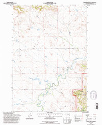
1993 Map of Lampkin Gulch
USGS Topo · Published 1996About this map
Boxelder Creek meanders through this portion of Carter County, Montana, providing a vital water source for the ranching operations that define the area's landscape. The map shows the Base Line dividing Township 1 North and Township 1 South, a critical surveying marker for the region's land management. The presence of the Ness Ranch and several fords along the watercourses illustrates how local settlers navigated and utilized the drainage systems. To the southeast, the Custer National Forest boundary marks a transition into protected lands, where Lampkin Gulch and various springs emerge from the more varied terrain. Small-scale infrastructure like the Flowing Well and Prairie Dale Road highlight the practical developments made by residents to support livestock and travel between isolated ranch sites in the late twentieth century.
Find a feature on this map
17 named features on this map. Tap any name to fly to it.
Don’t see what you’re looking for? This feature index may not catch every label — zoom into the map to look around manually.
Map Details
Editions of this 1993 Lampkin Gulch Map
This is the sole edition of this map. No revisions or reprints were ever made.
Other maps of this area

1954 · Ekalaka
USGS Topo · 1:250,000

1956 · Ekalaka
USGS Topo · 1:250,000

1958 · Ekalaka
USGS Topo · 1:250,000

1965 · Ekalaka
USGS Topo · 1:250,000

1980 · Taylor Hills
USGS Topo · 1:24,000

1980 · Belltower
USGS Topo · 1:24,000
1980 · Rustler Divide
USGS Topo · 1:24,000

1980 · Camp Needmore
USGS Topo · 1:24,000

1980 · Dutchmans Hill
USGS Topo · 1:24,000
1980 · Lampkin Gulch
USGS Topo · 1:24,000