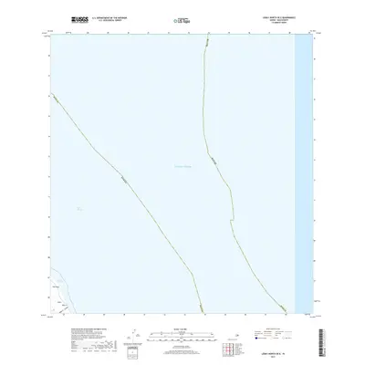
2017 Map of Lanai North OE E
USGS Topo · Published 2017About this map
The island of Lāna'i meets the sea along its northern coast, where the steep terrain of Kāhe'a and the drainage of Kāhe'a Gulch reach the shore. This 2017 survey by the U.S. Geological Survey focuses largely on the maritime expanse of the Pacific Ocean and the 'Au'au Channel, capturing the boundary between Maui County and the surrounding waters. A small portion of the landmass is visible in the southwestern corner of the sheet, centered on the area of Wai'ōpae. The map emphasizes the coastal orientation of this part of Hawaii, highlighting how the natural gulches and named coastal reaches define the landscape before the terrain drops off into the deep channels of the Pacific.
Find a feature on this map
9 named features on this map. Tap any name to fly to it.
Don’t see what you’re looking for? This feature index may not catch every label — zoom into the map to look around manually.
Map Details
Editions of this 2017 Lanai North OE E Map
This is the sole edition of this map. No revisions or reprints were ever made.
Other maps of this area

1923 · Island of Lanai
USGS Topo · 1:31,680

1925 · Island of Lanai
USGS Topo · 1:62,500

1954 · Maui
USGS Topo · 1:250,000

1955 · Olowalu
USGS Topo · 1:24,000

1956 · Lahaina
USGS Topo · 1:24,000

1956 · Honolua
USGS Topo · 1:24,000

1966 · Maui
USGS Topo · 1:250,000

1974 · Maui
USGS Topo · 1:250,000
1978 · Lahaina
USGS Topo · 1:24,000
1983 · Olowalu
USGS Topo · 1:24,000