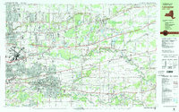
1982 Map of Lancaster
USGS Topo · Published 1983About this map
Greater Buffalo International Airport anchors the western edge of this Erie County landscape, reflecting the post-war expansion of suburban infrastructure and transport. The map documents a dense network of suburban development stretching from Williamsville and Depew through Lancaster, where the Conrail lines intersect with local industrial sites like the County Penitentiary (Industrial Farm). Residential growth is interspersed with older institutional landmarks, including the Sacred Heart Home and St Elizabeths Home for the Aged, alongside community recreation centers like the Lancaster Speedway and the Brookfield Country Club.
Find a feature on this map
77 named features on this map. Tap any name to fly to it.
Don’t see what you’re looking for? This feature index may not catch every label — zoom into the map to look around manually.
Map Details
Editions of this 1982 Lancaster Map
This is the sole edition of this map. No revisions or reprints were ever made.
Other maps of this area

1894 · Buffalo
USGS Topo · 1:62,500

1897 · Tonawanda
USGS Topo · 1:62,500

1897 · Medina
USGS Topo · 1:62,500

1897 · Lockport
USGS Topo · 1:62,500

1899 · Niagara
USGS Topo · 1:125,000

1900 · Tonawanda
USGS Topo · 1:62,500

1901 · Buffalo
USGS Topo · 1:62,500

1901 · Tonawanda
USGS Topo · 1:62,500

1902 · Lockport
USGS Topo · 1:62,500

1905 · Attica
USGS Topo · 1:62,500