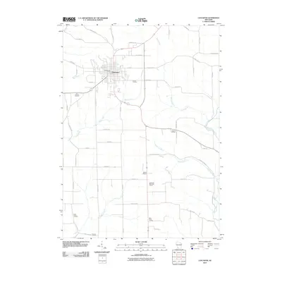
2010 Map of Lancaster
USGS Topo · Published 2010About this map
Lancaster serves as the focal point of this southwestern Wisconsin landscape, where the street grid of the county seat transitions into a network of agricultural roads and drainage basins. The area is defined by its numerous small burial grounds, including Hillside Cemetery just east of town and Saint Clements Cemetery to the southwest, reflecting the deep-rooted settlement patterns of Grant County. Further south, the rural community of Boice Prairie sits near the Lancaster Municipal Airport, surrounded by the winding tributaries of the Platte River and Boice Creek. The topography is marked by distinct valleys carved by waterways like Pigeon Creek and McPherson Branch, which dictate the placement of early routes such as Old Potosi Rd and S Boice Creek Rd. This survey documents the intersection of established town life and the enduring farmsteads of the driftless region.
Find a feature on this map
54 named features on this map. Tap any name to fly to it.
Don’t see what you’re looking for? This feature index may not catch every label — zoom into the map to look around manually.
Map Details
Editions of this 2010 Lancaster Map
This is the sole edition of this map. No revisions or reprints were ever made.
Other maps of this area

1900 · Lancaster
USGS Topo · 1:125,000

1904 · Lancaster
USGS Topo · 1:125,000

1908 · Lancaster
USGS Topo · 1:125,000

1955 · Balltown
USGS Topo · 1:24,000

1957 · Potosi
USGS Topo · 1:24,000

1959 · Dubuque
USGS Topo · 1:250,000

1961 · Dubuque
USGS Topo · 1:250,000
1961 · Dickeyville
USGS Topo · 1:24,000

1962 · Dubuque
USGS Topo · 1:250,000
1962 · Mount Hope
USGS Topo · 1:24,000