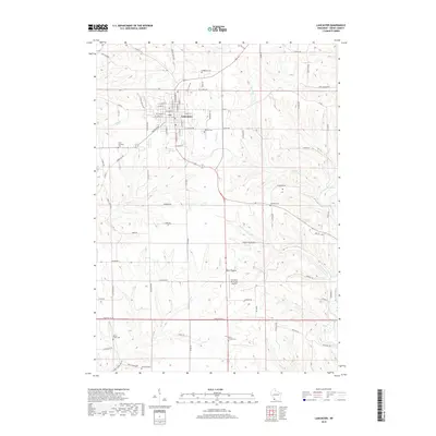
2018 Map of Lancaster
USGS Topo · Published 2018About this map
Lancaster serves as the focal point of this southwestern Wisconsin landscape, where the street grid is clearly defined by historical thoroughfares like E Lincoln Ave and S Madison ST. The surrounding Grant County countryside is a network of ridges and hollows, notably Coon Hollow Rd and Hudson Hollow Rd, drained by numerous tributaries of the Platte River. Genealogists will find several burial grounds across the area, including Saint Clements Cem and Hillside Cem near the town center, while smaller rural locations like Hampton Cem and Boice Creek Cem remain preserved in the outlying farmland. To the south, the settlement of Boice Prairie lies near the Lancaster Municipal Airport, illustrating the continued importance of this agricultural and aviation hub. Waterways like Pigeon Cr and Boice Cr wind through the township, marking the drainage patterns of the Driftless Area.
Find a feature on this map
75 named features on this map. Tap any name to fly to it.
Don’t see what you’re looking for? This feature index may not catch every label — zoom into the map to look around manually.
Map Details
Editions of this 2018 Lancaster Map
This is the sole edition of this map. No revisions or reprints were ever made.
Other maps of this area

1900 · Lancaster
USGS Topo · 1:125,000

1904 · Lancaster
USGS Topo · 1:125,000

1908 · Lancaster
USGS Topo · 1:125,000

1955 · Balltown
USGS Topo · 1:24,000

1957 · Potosi
USGS Topo · 1:24,000

1959 · Dubuque
USGS Topo · 1:250,000

1961 · Dubuque
USGS Topo · 1:250,000
1961 · Dickeyville
USGS Topo · 1:24,000

1962 · Dubuque
USGS Topo · 1:250,000
1962 · Mount Hope
USGS Topo · 1:24,000