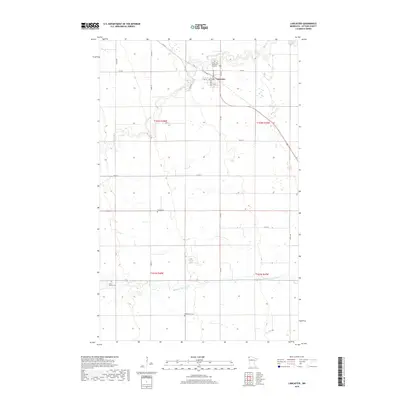
2019 Map of Lancaster
USGS Topo · Published 2019About this map
Lancaster serves as the focal point of this northern Minnesota landscape, situated at the intersection of Central Ave and several major county roads. The town's grid is clearly defined, with Minnesota Ave and Iowa Ave framing the residential and commercial center near the N Br Two Rivers. Outside the immediate settlement, the terrain is shaped by the meandering paths of the North and Middle Br Two Rivers, which cut through the agricultural sections of Kittson County.
Find a feature on this map
27 named features on this map. Tap any name to fly to it.
Don’t see what you’re looking for? This feature index may not catch every label — zoom into the map to look around manually.
Map Details
Editions of this 2019 Lancaster Map
This is the sole edition of this map. No revisions or reprints were ever made.
Other maps of this area

1918 · Hemmington
USGS Topo · 1:62,500

1939 · Kennedy
USGS Topo · 1:62,500

1941 · Kennedy
USGS Topo · 1:62,500

1941 · Hallock
USGS Topo · 1:62,500

1952 · Thief River Falls
USGS Topo · 1:250,000

1956 · Thief River Falls
USGS Topo · 1:250,000

1956 · Karlstad
USGS Topo · 1:62,500

1957 · Thief River Falls
USGS Topo · 1:250,000

1966 · Skull Lake
USGS Topo · 1:24,000
1966 · Skull Lake SW
USGS Topo · 1:24,000