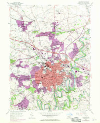
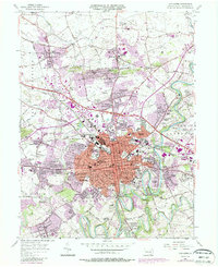
1956 Map of Lancaster
USGS Topo · Published 1970About this map
Franklin and Marshall College and the campus of the State Teachers College anchor this detailed study of the Pennsylvania Dutch country's urban center during a period of rapid post-war expansion. While the historic core of Lancaster remains dense with civic landmarks like City Hall and the Courthouse, purple revision tints show suburban growth pushing toward East Petersburg and Neffsville. The landscape is a complex mix of industrial infrastructure, including the Stockyards and various plants along the Reading RR, and institutional sites such as the Monastery of the Perpetual Rosary. Beyond the city limits, the winding Conestoga River and tributaries like Little Conestoga Creek define the transitions into Manheim and Lampeter townships. This 1956 survey, updated with 1969 aerial data, captures the conversion of traditional farmland into residential developments like Beverly Estates and School Lane Hills.
Find a feature on this map
135 named features on this map. Tap any name to fly to it.
Don’t see what you’re looking for? This feature index may not catch every label — zoom into the map to look around manually.
Map Details
Editions of this 1956 Lancaster Map
5 editions found
Other maps of this area

1902 · Lancaster
USGS Topo · 1:62,500

1904 · Lancaster
USGS Topo · 1:62,500

1906 · New Holland
USGS Topo · 1:62,500

1908 · New Holland
USGS Topo · 1:62,500

1912 · Quarryville
USGS Topo · 1:62,500

1912 · Mc Calls Ferry
USGS Topo · 1:62,500

1941 · New Holland
USGS Topo · 1:62,500

1943 · Lancaster
USGS Topo · 1:62,500

1943 · Quarryville
USGS Topo · 1:62,500

1943 · Mc Calls Ferry
USGS Topo · 1:62,500
Featured Places
- Lancaster, PA
- West Lampeter Township, PA
- Willow Street, West Lampeter Township
- Millersville, PA
- East Petersburg, PA