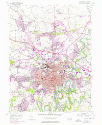
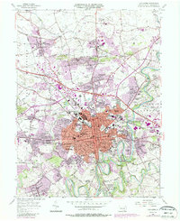
1956 Map of Lancaster
USGS Topo · Published 1977About this map
The Conestoga River and Little Conestoga Creek frame the historic city of Lancaster, a region defined by its dense educational and institutional footprint in the mid-20th century. This survey highlights the sprawling campus of Franklin and Marshall College and numerous civic anchors like St Josephs Hospital and the McCaskey High Sch. The urban core is surrounded by established residential neighborhoods such as Wheatland and Rossmere, while the purple photorevision overlays reveal the rapid post-war suburbanization reaching toward Neffsville and East Petersburg.
Find a feature on this map
126 named features on this map. Tap any name to fly to it.
Don’t see what you’re looking for? This feature index may not catch every label — zoom into the map to look around manually.
Map Details
Editions of this 1956 Lancaster Map
5 editions found
Other maps of this area

1902 · Lancaster
USGS Topo · 1:62,500

1904 · Lancaster
USGS Topo · 1:62,500

1906 · New Holland
USGS Topo · 1:62,500

1908 · New Holland
USGS Topo · 1:62,500

1912 · Quarryville
USGS Topo · 1:62,500

1912 · Mc Calls Ferry
USGS Topo · 1:62,500

1941 · New Holland
USGS Topo · 1:62,500

1943 · Lancaster
USGS Topo · 1:62,500

1943 · Quarryville
USGS Topo · 1:62,500

1943 · Mc Calls Ferry
USGS Topo · 1:62,500
Featured Places
- Lancaster, PA
- West Lampeter Township, PA
- Willow Street, West Lampeter Township
- Millersville, PA
- East Petersburg, PA