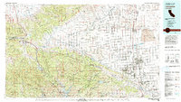
1981 Map of Lancaster
USGS Topo · Published 1984About this map
Antelope Valley stretches across the center of this 1981 survey, serving as a vast transition between the high desert and the steep ridges of the Tehachapi Mountains and Sierra Pelona. The San Andreas Rift Zone is a dominant geological feature, slicing through the landscape and influencing the location of settlements like Lake Hughes and Elizabeth Lake. Transport and energy infrastructure are prominent, with the California Aqueduct winding along the valley floor and major routes like the Golden State Freeway and Antelope Valley Freeway funneling traffic through the passes. To the east, the sprawling footprint of Edwards Air Force Base and Air Force Plant 42 highlights the region's importance to the aerospace industry. Mining history is preserved in the Bissell Hills area with the Golden Queen Mine, while natural conservation is represented by the Sespe Condor Sanctuary and Antelope Valley California Poppy State Reserve.
Find a feature on this map
97 named features on this map. Tap any name to fly to it.
Don’t see what you’re looking for? This feature index may not catch every label — zoom into the map to look around manually.
Map Details
Editions of this 1981 Lancaster Map
2 editions found
Other maps of this area

1900 · Tujunga
USGS Topo · 1:62,500

1900 · Fernando
USGS Topo · 1:62,500

1900 · Piru
USGS Topo · 1:62,500

1901 · Southern California Sheet No. 1
USGS Topo · 1:250,000

1903 · Santa Paula
USGS Topo · 1:62,500

1903 · Mt. Pinos
USGS Topo · 1:125,000

1903 · Tejon
USGS Topo · 1:125,000

1903 · Rock Creek
USGS Topo · 1:62,500

1903 · Camulos
USGS Topo · 1:125,000

1903 · Santa Susana
USGS Topo · 1:62,500