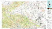
1981 Map of Lancaster
USGS Topo · Published 1984About this map
The high desert landscape of Antelope Valley transitions from the sprawling residential growth of Lancaster and Palmdale to the massive infrastructure of the Edwards Air Force Base flight test center. This 1981 survey documents the path of the California Aqueduct as it skirts the northern edge of the Portal Ridge, fundamentally altering the water distribution for this arid region. The geography is defined by the San Andreas Rift Zone, a visible tectonic scar running through the Sierra Pelona and Angeles National Forest. To the west, the Golden State Freeway provides a primary artery through the mountains, passing near the Fort Tejon State Hist Park and the rugged peaks of the Los Padres National Forest. The map also captures specialized land uses, from the Antelope Valley California Poppy State Reserve to the Sespe Condor Sanctuary, highlighting the region's diverse environmental conservation efforts amidst mid-century expansion.
Find a feature on this map
63 named features on this map. Tap any name to fly to it.
Don’t see what you’re looking for? This feature index may not catch every label — zoom into the map to look around manually.
Map Details
Editions of this 1981 Lancaster Map
2 editions found
Other maps of this area

1900 · Tujunga
USGS Topo · 1:62,500

1900 · Fernando
USGS Topo · 1:62,500

1900 · Piru
USGS Topo · 1:62,500

1901 · Southern California Sheet No. 1
USGS Topo · 1:250,000

1903 · Santa Paula
USGS Topo · 1:62,500

1903 · Mt. Pinos
USGS Topo · 1:125,000

1903 · Tejon
USGS Topo · 1:125,000

1903 · Rock Creek
USGS Topo · 1:62,500

1903 · Camulos
USGS Topo · 1:125,000

1903 · Santa Susana
USGS Topo · 1:62,500