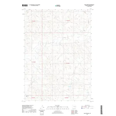
2017 Map of Lance Creek NW
USGS Topo · Published 2017About this map
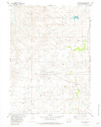
Niobrara County's high plains drainage patterns are meticulously charted in this 2017 survey, where a complex network of intermittent watercourses dictates the landscape's character. Significant water management features such as Obrien Number 1 Reservoir and Wildcat Reservoir stand out as vital points in an otherwise arid environment. These reservoirs serve as anchors for the local ranching infrastructure, connected by a sparse grid of gravel routes including Kruse Rd and Cow Creek Rd. The terrain is defined by dramatic erosion features like Twentymile Gulch and the winding paths of Lightning Cr and Twentymile Cr. This map captures the modern distribution of land and water in a part of Wyoming where the legacy of early 20th-century homesteading and cattle ranching remains the primary shaper of the land.
Find a feature on this map
15 named features on this map. Tap any name to fly to it.
Don’t see what you’re looking for? This feature index may not catch every label — zoom into the map to look around manually.
Map Details
Editions of this 2017 Lance Creek NW Map
This is the sole edition of this map. No revisions or reprints were ever made.
Other maps of this area

1955 · Newcastle
USGS Topo · 1:250,000

1958 · Newcastle
USGS Topo · 1:250,000

1981 · Calf Draw
USGS Topo · 1:24,000

1981 · Mercer Draw
USGS Topo · 1:24,000
1981 · Rabbit Mountains
USGS Topo · 1:24,000

1981 · Dixon Ranch
USGS Topo · 1:24,000

1981 · Lance Creek NW
USGS Topo · 1:24,000
1981 · Boggy Reservoir
USGS Topo · 1:24,000
1981 · Funny Rock
USGS Topo · 1:24,000
1981 · Lance Creek
USGS Topo · 1:24,000