
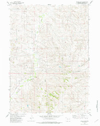
1981 Map of Lance Creek NW
USGS Topo · Published 1981About this map
Lightning Creek meanders across this High Plains landscape in Niobrara County, carving a distinctive riparian corridor through the dry Wyoming terrain. Surveyed in the mid-1970s and edited in 1981, the map documents a territory defined by resource extraction and cattle ranching. The presence of numerous Drill Holes and an Oil Well scattered across the township and range sections illustrates the energy exploration footprint of the era. The drainage network is further defined by Cow Creek in the north and the deep incision of Twentymile Gulch in the southwest, showing how water availability dictated land use in this semi-arid region. These features, along with extensive fence lines, reflect a landscape structured by both geology and the practicalities of western rangeland management.
Find a feature on this map
8 named features on this map. Tap any name to fly to it.
Don’t see what you’re looking for? This feature index may not catch every label — zoom into the map to look around manually.
Map Details
Editions of this 1981 Lance Creek NW Map
This is the sole edition of this map. No revisions or reprints were ever made.
Other maps of this area

1955 · Newcastle
USGS Topo · 1:250,000

1958 · Newcastle
USGS Topo · 1:250,000

1981 · Calf Draw
USGS Topo · 1:24,000

1981 · Mercer Draw
USGS Topo · 1:24,000
1981 · Rabbit Mountains
USGS Topo · 1:24,000

1981 · Dixon Ranch
USGS Topo · 1:24,000
1981 · Boggy Reservoir
USGS Topo · 1:24,000
1981 · Funny Rock
USGS Topo · 1:24,000
1981 · Lance Creek
USGS Topo · 1:24,000
1981 · Mikes Draw
USGS Topo · 1:24,000