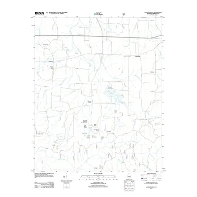
2011 Map of Landersville
USGS Topo · Published 2011About this map
Landersville and the surrounding Lawrence County uplands are defined by a network of rural settlements and family cemeteries. Small communities such as Mount Hope, Needmore, and Hickory Grove anchor a landscape bisected by numerous waterways including Town Creek and the curiously named Troublesome Creek. The terrain transitions from the relatively level agricultural lands in the north to more complex topography in the south, where Stinson Gap and McClung Gap provide passage through the rising ridges.
Find a feature on this map
94 named features on this map. Tap any name to fly to it.
Don’t see what you’re looking for? This feature index may not catch every label — zoom into the map to look around manually.
Map Details
Editions of this 2011 Landersville Map
This is the sole edition of this map. No revisions or reprints were ever made.
Other maps of this area

1924 · Tuscumbia
USGS Topo · 1:48,000

1926 · Tuscumbia
USGS Topo · 1:62,500

1935 · Moulton
USGS Topo · 1:24,000

1936 · Newburg
USGS Topo · 1:24,000

1936 · Kinlock Spring
USGS Topo · 1:24,000

1936 · Moulton
USGS Topo · 1:48,000

1936 · Masterson
USGS Topo · 1:24,000

1936 · Hatton
USGS Topo · 1:24,000

1936 · Landersville
USGS Topo · 1:24,000
1936 · Old Bethel
USGS Topo · 1:24,000