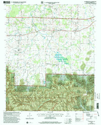
2000 Map of Landersville
USGS Topo · Published 2003About this map
The Moulton Valley terrain transitions sharply into the forested uplands of the William B Bankhead National Forest in this survey updated at the turn of the millennium. The northern half of the quadrangle is defined by agricultural lands and small communities such as Landersville and Mt Hope, connected by the historic route of Byler Road. This area is dense with genealogical markers, including Cave Springs Cem and Old Prospect Cem, alongside local landmarks like the Mt Hope Sch. To the south, the landscape shifts dramatically at the Tennessee Valley Divide, where the Black Warrior Wildlife Management Area and the Sipsey Wilderness protect the headwaters of Borden Creek. Points like Goat Bluff and Walker Gap mark the steep descent from the ridge into the deep hollows of the national forest system.
Find a feature on this map
48 named features on this map. Tap any name to fly to it.
Don’t see what you’re looking for? This feature index may not catch every label — zoom into the map to look around manually.
Map Details
Editions of this 2000 Landersville Map
This is the sole edition of this map. No revisions or reprints were ever made.
Other maps of this area

1924 · Tuscumbia
USGS Topo · 1:48,000

1926 · Tuscumbia
USGS Topo · 1:62,500

1935 · Moulton
USGS Topo · 1:24,000

1936 · Newburg
USGS Topo · 1:24,000

1936 · Kinlock Spring
USGS Topo · 1:24,000

1936 · Moulton
USGS Topo · 1:48,000

1936 · Masterson
USGS Topo · 1:24,000

1936 · Hatton
USGS Topo · 1:24,000

1936 · Landersville
USGS Topo · 1:24,000
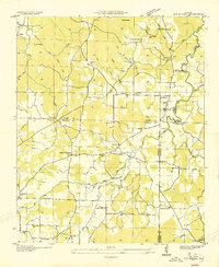
1936 · Old Bethel
USGS Topo · 1:24,000