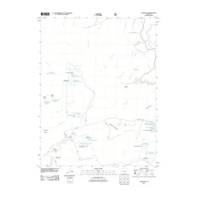
2011 Map of Lands End
USGS Topo · Published 2011About this map
Grand Mesa dominates the southern landscape of this 2011 survey, where the dramatic elevation drop toward Whitewater Basin is traced by the winding Lands End Rd. This terrain is defined by an extensive water management system composed of numerous high-altitude catchments, including the Palisade Reservoir Number 3, Robbins Reservoir, and the Somerville-McCullah Reservoir. The map illustrates the complex hydrography of the western slope, where the South Side Canal and various dams regulate the flow of North Fork Kannah Creek and Rapid Creek. Recreational development is centered around the Powderhorn Ski Area and public sites like the Wild Rose Picnic Ground and Steamboat Rock Campground near the landmark Steamboat Rock. Together, these features reveal a landscape heavily utilized for both mountain recreation and essential water storage in a semi-arid region.
Find a feature on this map
55 named features on this map. Tap any name to fly to it.
Don’t see what you’re looking for? This feature index may not catch every label — zoom into the map to look around manually.
Map Details
Editions of this 2011 Lands End Map
This is the sole edition of this map. No revisions or reprints were ever made.
Other maps of this area

1955 · Cameo
USGS Topo · 1:24,000

1955 · Mesa
USGS Topo · 1:24,000

1955 · Molina
USGS Topo · 1:24,000

1955 · Skyway
USGS Topo · 1:24,000

1956 · Moab
USGS Topo · 1:250,000

1956 · Grand Junction
USGS Topo · 1:250,000

1959 · Grand Junction
USGS Topo · 1:250,000

1959 · Moab
USGS Topo · 1:250,000

1960 · Moab
USGS Topo · 1:250,000

1960 · Grand Junction
USGS Topo · 1:250,000