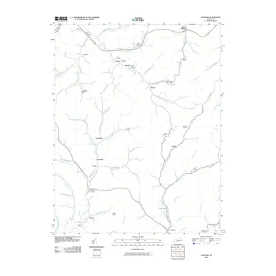
2010 Map of Landsaw
USGS Topo · Published 2010About this map
Stillwater Creek and its many winding tributaries define this portion of the Kentucky Cumberland Plateau, where small settlements and family cemeteries are tucked into narrow valleys and hollows. Rural communities like Baptist, Landsaw, and Malaga are connected by a network of winding roads such as Landsaw Rd and Pryor Fork Rd, following the natural drainage of the land. The presence of the Bethany Post Office near Pence and the numerous family burial grounds, including the Centers-Rose Cemetery and Tackett-Wells Cemetery, points to a long-established pattern of generational family homesteads. To the south, Vancleve and Sewell sit along the creek banks, while features like Leslie Hollow and Cedar Ridge illustrate the complex elevation shifts that historically isolated these highland communities.
Find a feature on this map
85 named features on this map. Tap any name to fly to it.
Don’t see what you’re looking for? This feature index may not catch every label — zoom into the map to look around manually.
Map Details
Editions of this 2010 Landsaw Map
This is the sole edition of this map. No revisions or reprints were ever made.
Other maps of this area

1889 · Salyersville
USGS Topo · 1:125,000

1891 · Salyersville
USGS Topo · 1:125,000

1892 · Beattyville
USGS Topo · 1:125,000

1899 · Salyersville
USGS Topo · 1:125,000

1951 · Cannel City
USGS Topo · 1:24,000

1951 · Landsaw
USGS Topo · 1:24,000

1951 · Hazel Green
USGS Topo · 1:24,000

1951 · Pomeroyton
USGS Topo · 1:24,000

1951 · Quicksand
USGS Topo · 1:24,000

1951 · Jackson
USGS Topo · 1:24,000