
1951 Map of Pomeroyton
USGS Topo · Published 1953About this map
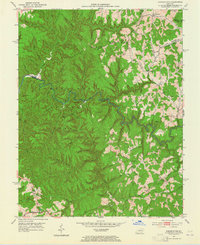
The Red River carves a deep, winding path through this corner of Wolfe County, shaping a landscape of steep ridges and narrow hollows. Established in the early 1950s, this survey captures the rural character of the region where small settlements like Pomeroyton and Valeria serve as local anchors. The map reveals the intricate drainage patterns of the Kentucky mountains, with numerous unnamed branches and creeks feeding into the main river corridor. For those tracing local history, the placement of structures and trails relative to the river's bends provides a clear picture of how the terrain dictated settlement and transit in this part of the Cumberland Plateau before more modern infrastructure arrived.
Find a feature on this map
3 named features on this map. Tap any name to fly to it.
Don’t see what you’re looking for? This feature index may not catch every label — zoom into the map to look around manually.
Map Details
Editions of this 1951 Pomeroyton Map
2 editions found
Other maps of this area

1889 · Salyersville
USGS Topo · 1:125,000

1891 · Salyersville
USGS Topo · 1:125,000

1892 · Beattyville
USGS Topo · 1:125,000

1899 · Salyersville
USGS Topo · 1:125,000

1951 · Landsaw
USGS Topo · 1:24,000

1951 · Ezel
USGS Topo · 1:24,000

1951 · Hazel Green
USGS Topo · 1:24,000

1952 · Scranton
USGS Topo · 1:24,000

1952 · Frenchburg
USGS Topo · 1:24,000

1952 · Slade
USGS Topo · 1:24,000