
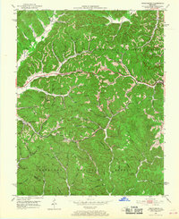
1952 Map of Frenchburg
USGS Topo · Published 1953About this map
The town of Frenchburg serves as the focal point of this 1952 study, situated at the eastern edge of the Cumberland National Forest. The landscape is dominated by a dense network of hollows and ridges, such as McCausey Ridge and Joe Smallwood Ridge, which dictated the early settlement patterns of Menifee County. Small community clusters like Goosetown and Cornwell appear along the valley floors, often anchored by local institutions including Tabor Ch and the Goosetown Sch.
Find a feature on this map
94 named features on this map. Tap any name to fly to it.
Don’t see what you’re looking for? This feature index may not catch every label — zoom into the map to look around manually.
Map Details
Editions of this 1952 Frenchburg Map
2 editions found
Other maps of this area

1892 · Beattyville
USGS Topo · 1:125,000

1929 · Salt Lick
USGS Topo · 1:62,500

1934 · Salt Lick
USGS Topo · 1:62,500

1951 · Pomeroyton
USGS Topo · 1:24,000

1952 · Preston
USGS Topo · 1:24,000

1952 · Scranton
USGS Topo · 1:24,000

1952 · Stanton
USGS Topo · 1:24,000

1952 · Means
USGS Topo · 1:24,000

1952 · Slade
USGS Topo · 1:24,000

1953 · Olympia
USGS Topo · 1:24,000