
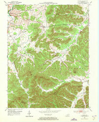
1953 Map of Olympia
USGS Topo · Published 1954About this map
The industrial and recreational heritage of Bath and Menifee Counties is preserved here during the early 1950s. The site of Bourbon Furnace (Ruins) near Slate Creek stands as a primary landmark, indicating the area's early iron production roots. The landscape is defined by the sharp transition from the rail-oriented settlement of Olympia, situated along the Chesapeake and Ohio railroad, to the densely wooded elevations of the Cumberland National Forest.
Find a feature on this map
47 named features on this map. Tap any name to fly to it.
Don’t see what you’re looking for? This feature index may not catch every label — zoom into the map to look around manually.
Map Details
Editions of this 1953 Olympia Map
2 editions found
Other maps of this area

1892 · Beattyville
USGS Topo · 1:125,000

1929 · Salt Lick
USGS Topo · 1:62,500

1934 · Salt Lick
USGS Topo · 1:62,500

1952 · Preston
USGS Topo · 1:24,000

1952 · Owingsville
USGS Topo · 1:24,000

1952 · Scranton
USGS Topo · 1:24,000

1952 · Frenchburg
USGS Topo · 1:24,000

1952 · Means
USGS Topo · 1:24,000

1953 · Farmers
USGS Topo · 1:24,000
1953 · Salt Lick
USGS Topo · 1:24,000