
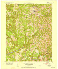
1952 Map of Slade
USGS Topo · Published 1954About this map
Natural Bridge State Park dominates the southern landscape of this 1952 study, centered on the sandstone arch of the Natural Bridge itself. The settlement of Slade serves as a local hub near the confluence of the Red River and its forks, while further west, the village of Nada marks a point of historical entry into the gorge. The map documents an industrial transition, notably featuring an Abandoned RR Tunnel that once served the timber and mineral interests of the region. Evidence of rural community life is scattered throughout the hollows and ridges, including the South Fork Ch and several isolated schoolhouses like Tin Town Sch and Crow Sch. The jagged topography is defined by narrow divides such as Hatton Ridge and the aptly named Pinch-Em Tight Ridge, which channeled early roads and settlements into the protected valley floors.
Find a feature on this map
84 named features on this map. Tap any name to fly to it.
Don’t see what you’re looking for? This feature index may not catch every label — zoom into the map to look around manually.
Map Details
Editions of this 1952 Slade Map
This is the sole edition of this map. No revisions or reprints were ever made.
Other maps of this area

1892 · Beattyville
USGS Topo · 1:125,000

1951 · Pomeroyton
USGS Topo · 1:24,000

1952 · Scranton
USGS Topo · 1:24,000

1952 · Frenchburg
USGS Topo · 1:24,000

1952 · Stanton
USGS Topo · 1:24,000

1952 · Means
USGS Topo · 1:24,000

1952 · Cobhill
USGS Topo · 1:24,000
1952 · Campton
USGS Topo · 1:24,000

1953 · Zachariah
USGS Topo · 1:24,000

1957 · Jenkins
USGS Topo · 1:250,000