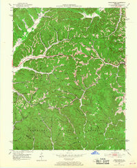
1952 Map of Frenchburg
USGS Topo · Published 1968About this map
Frenchburg and the surrounding hollows of the Cumberland National Forest appear in high detail during this early 1950s survey. The landscape is defined by its industrial reliance on subterranean resources, evidenced by the numerous gas wells and oil wells scattered throughout the drainage basins of Slate Creek and Beaver Creek. The settlement pattern follows the narrow valley floors, where small communities like Cornwell, Rothwell, and Fagan are linked by a network of rural schools and family landmarks.
Find a feature on this map
85 named features on this map. Tap any name to fly to it.
Don’t see what you’re looking for? This feature index may not catch every label — zoom into the map to look around manually.
Map Details
Editions of this 1952 Frenchburg Map
2 editions found
Other maps of this area

1892 · Beattyville
USGS Topo · 1:125,000

1929 · Salt Lick
USGS Topo · 1:62,500

1934 · Salt Lick
USGS Topo · 1:62,500

1951 · Pomeroyton
USGS Topo · 1:24,000

1952 · Preston
USGS Topo · 1:24,000

1952 · Scranton
USGS Topo · 1:24,000

1952 · Frenchburg
USGS Topo · 1:24,000

1952 · Stanton
USGS Topo · 1:24,000

1952 · Means
USGS Topo · 1:24,000

1952 · Slade
USGS Topo · 1:24,000