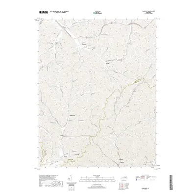
2019 Map of Landsaw
USGS Topo · Published 2019About this map
Baptist and Landsaw sit within a landscape defined by the deep dissection of the Cumberland Plateau, where life follows the narrow corridors of creek beds and hollows. The boundary between Wolfe and Breathitt counties winds through these ridges, separating small communities like Hollonville and Bethany from the southern settlements of Vancleve and Sewell. The map reveals a dense network of family-named cemeteries, including the Tackett-Wells Cem and Puckett Cem, which are often located on the high shoulders above the watercourses. Transportation is anchored by the Bert T. Combs Mountain Parkway in the north, contrasting with the winding rural routes like Lacy Creek Rd and Pence Branch Rd that serve the interior hollows. Numerous forks and branches, such as Stillwater Cr and Johnson Fork, dictate the placement of homes and small clusters of buildings throughout this Appalachian terrain.
Find a feature on this map
97 named features on this map. Tap any name to fly to it.
Don’t see what you’re looking for? This feature index may not catch every label — zoom into the map to look around manually.
Map Details
Editions of this 2019 Landsaw Map
This is the sole edition of this map. No revisions or reprints were ever made.
Other maps of this area

1889 · Salyersville
USGS Topo · 1:125,000

1891 · Salyersville
USGS Topo · 1:125,000

1892 · Beattyville
USGS Topo · 1:125,000

1899 · Salyersville
USGS Topo · 1:125,000

1951 · Cannel City
USGS Topo · 1:24,000

1951 · Landsaw
USGS Topo · 1:24,000

1951 · Hazel Green
USGS Topo · 1:24,000

1951 · Pomeroyton
USGS Topo · 1:24,000

1951 · Quicksand
USGS Topo · 1:24,000

1951 · Jackson
USGS Topo · 1:24,000