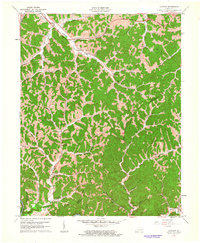
1961 Map of Landsaw
USGS Topo · Published 1963About this map
Stillwater Creek and Lacy Creek wind through the dissected plateau of eastern Kentucky, where small valley settlements and family institutions define the early 1960s landscape. This area, spanning the border of Wolfe and Breathitt counties, is characterized by its network of narrow forks and branches, including Baptist Fork and Holly Creek. The Bethany Childrens Home stands as a significant landmark in the southern portion of the sheet, while the newer Mountain Parkway cuts across the northern ridges, signaling a shift in regional transportation. Genealogical interest is high throughout the map, with numerous small burial grounds and rural institutions like the Centers-Rose Cem, Hollonville Sch, and Rose Dale Ch located in the hollows. Small-scale industrial activity is evidenced by a Strip Mine and a Gas Well, illustrating the extraction-based economy of the Cumberland Plateau during this era.
Find a feature on this map
64 named features on this map. Tap any name to fly to it.
Don’t see what you’re looking for? This feature index may not catch every label — zoom into the map to look around manually.
Map Details
Editions of this 1961 Landsaw Map
This is the sole edition of this map. No revisions or reprints were ever made.
Other maps of this area

1889 · Salyersville
USGS Topo · 1:125,000

1891 · Salyersville
USGS Topo · 1:125,000

1892 · Beattyville
USGS Topo · 1:125,000

1899 · Salyersville
USGS Topo · 1:125,000

1951 · Cannel City
USGS Topo · 1:24,000

1951 · Landsaw
USGS Topo · 1:24,000

1951 · Hazel Green
USGS Topo · 1:24,000

1951 · Pomeroyton
USGS Topo · 1:24,000

1951 · Quicksand
USGS Topo · 1:24,000

1951 · Jackson
USGS Topo · 1:24,000