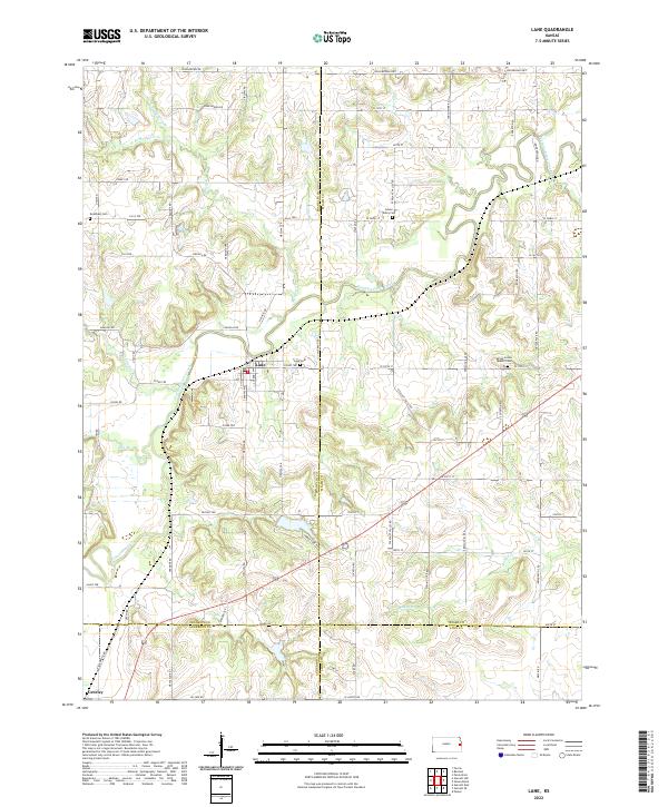
2022 Map of Lane
USGS Topo · Published 2022About this map
Pottawatomie Creek defines the local landscape as it winds through the southeast corner of Franklin County, providing a primary drainage for numerous tributaries like Mosquito Cr and Mound Cr. The town of Lane serves as a central hub, situated near the intersection of several county lines where Franklin, Miami, Anderson, and Linn counties converge. This area is noted for its early Quaker settlement roots, evidenced by the Spring Grove Quaker Cem east of town, while other family and community burial sites such as Needham Cem and Green Valley Cem offer significant data points for genealogists. The road network reflects local history and memorialization, specifically along the northern edge with John Brown Hwy and John Brown Rd, honoring the abolitionist's deep ties to this specific Kansas border region. Farther south, the settlement of Greeley anchors the lower western edge of the quadrangle near the Anderson County line.
Find a feature on this map
51 named features on this map. Tap any name to fly to it.
Don’t see what you’re looking for? This feature index may not catch every label — zoom into the map to look around manually.
Map Details
Editions of this 2022 Lane Map
This is the sole edition of this map. No revisions or reprints were ever made.
Other maps of this area

1885 · Garnett
USGS Topo · 1:125,000

1885 · Lawrence
USGS Topo · 1:125,000

1887 · Olathe
USGS Topo · 1:125,000

1887 · Mound City
USGS Topo · 1:125,000

1889 · Lawrence
USGS Topo · 1:125,000

1893 · Mound City
USGS Topo · 1:125,000

1893 · Olathe
USGS Topo · 1:125,000

1894 · Garnett
USGS Topo · 1:125,000

1947 · Lawrence
USGS Topo · 1:250,000

1950 · Lawrence
USGS Topo · 1:250,000