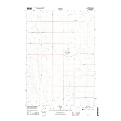
2015 Map of Lane
USGS Topo · Published 2015About this map
The small prairie settlement of Lane serves as the focal point for this survey of the Jerauld County countryside. Situated along the road network of 229th St and 389th Ave, the village is laid out with a grid including Maple Ave, Oak Ave, and Rambo Ave. The surrounding landscape is defined by the wandering course of Firesteel Cr, which cuts through the western sections of the township. This agricultural region is meticulously divided by the Public Land Survey System, with the map showing the intersection of townships T108N, T107N, and T106N. Located north of the village, Fairview Cem provides a primary point of interest for genealogists and local historians tracing the early families of the Franklin Township area.
Find a feature on this map
28 named features on this map. Tap any name to fly to it.
Don’t see what you’re looking for? This feature index may not catch every label — zoom into the map to look around manually.
Map Details
Editions of this 2015 Lane Map
This is the sole edition of this map. No revisions or reprints were ever made.
Other maps of this area

1898 · Huron
USGS Topo · 1:125,000

1899 · Mitchell
USGS Topo · 1:125,000

1942 · Crow Lake
USGS Topo · 1:62,500

1953 · Huron
USGS Topo · 1:250,000

1954 · Huron
USGS Topo · 1:250,000

1955 · Mitchell
USGS Topo · 1:250,000

1959 · Mitchell
USGS Topo · 1:250,000

1973 · Alpena
USGS Topo · 1:24,000

1973 · Wessington Springs NE
USGS Topo · 1:24,000
1973 · Woonsocket
USGS Topo · 1:24,000