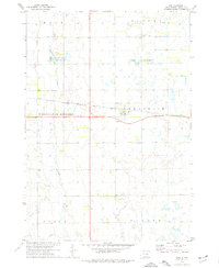
1973 Map of Lane
USGS Topo · Published 1976About this map
The town of Lane serves as a focal point for this Jerauld County landscape, where the Chicago Milwaukee St Paul and Pacific railroad cuts a straight path across the prairie. This mid-1970s survey captures a rural environment defined by sectional boundaries and small-scale water management, evidenced by the numerous Gravel Pits and groundwater sources like the Flowing Well. The intersection of townships including Franklin, Alpena, and Wessington Springs illustrates the formal organization of the South Dakota plains.
Find a feature on this map
16 named features on this map. Tap any name to fly to it.
Don’t see what you’re looking for? This feature index may not catch every label — zoom into the map to look around manually.
Map Details
Editions of this 1973 Lane Map
This is the sole edition of this map. No revisions or reprints were ever made.
Other maps of this area

1898 · Huron
USGS Topo · 1:125,000

1899 · Mitchell
USGS Topo · 1:125,000

1942 · Crow Lake
USGS Topo · 1:62,500

1953 · Huron
USGS Topo · 1:250,000

1954 · Huron
USGS Topo · 1:250,000

1955 · Mitchell
USGS Topo · 1:250,000

1959 · Mitchell
USGS Topo · 1:250,000

1973 · Alpena
USGS Topo · 1:24,000

1973 · Wessington Springs NE
USGS Topo · 1:24,000
1973 · Woonsocket
USGS Topo · 1:24,000