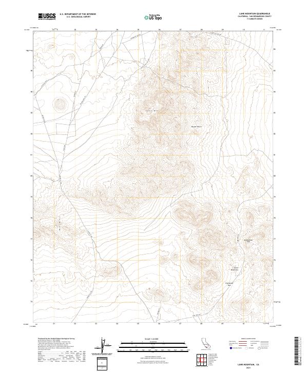
2021 Map of Lane Mountain
USGS Topo · Published 2021About this map
The Lane Mtn summit dominates this portion of the Mojave Desert, marking a central point in a high-desert landscape defined by dry basins and weathered ranges. Access into the interior is traced by several historical desert routes, including Copper City Rd and Starbright Mine Rd, which hint at the region's mining heritage. Near the western edge, the Mud Hills offer a stark topographical contrast, while to the southeast, the terrain transitions into the Calico Mountains.
Find a feature on this map
20 named features on this map. Tap any name to fly to it.
Don’t see what you’re looking for? This feature index may not catch every label — zoom into the map to look around manually.
Map Details
Editions of this 2021 Lane Mountain Map
This is the sole edition of this map. No revisions or reprints were ever made.
Other maps of this area

1915 · Searles Lake
USGS Topo · 1:250,000

1932 · Barstow
USGS Topo · 1:125,000

1933 · Avawatz Mountains
USGS Topo · 1:250,000

1934 · Barstow
USGS Topo · 1:125,000

1947 · Trona
USGS Topo · 1:250,000

1948 · Trona
USGS Topo · 1:250,000

1948 · Lane Mountain
USGS Topo · 1:62,500

1951 · Lane Mountain
USGS Topo · 1:62,500

1953 · San Bernardino
USGS Topo · 1:250,000

1953 · Yermo
USGS Topo · 1:24,000