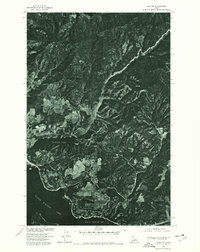
1975 Map of Lane NW
USGS Topo · Published 1978About this map
Coeur D'Alene Lake defines the southern portion of this mid-1970s orthophotoquad, showcasing the jagged shoreline where the water meets the dense, forested terrain of Kootenai County. The imagery captures the transition from the developed edge of Coeur D'Alene into the more secluded waters of Fernan Lake and its feeder, Fernan Creek. Produced in cooperation with the Bureau of Indian Affairs and the Soil Conservation Service, this photographic record emphasizes the landscape's natural drainage patterns and the heavy timber cover characteristic of northern Idaho. To the southeast, the wide expanse of Wolf Lodge Bay provides a clear view of the lake's reach into the surrounding mountains. Unlike a traditional topographic line map, this orthophotograph preserves the actual texture of the 1975 landscape, including clearings, forest roads, and early residential clusters as they appeared before decades of subsequent growth.
Find a feature on this map
5 named features on this map. Tap any name to fly to it.
Don’t see what you’re looking for? This feature index may not catch every label — zoom into the map to look around manually.
Map Details
Editions of this 1975 Lane NW Map
This is the sole edition of this map. No revisions or reprints were ever made.
Other maps of this area

1903 · Rathdrum
USGS Topo · 1:125,000

1955 · Spokane
USGS Topo · 1:250,000

1957 · Coeur D'Alene
USGS Topo · 1:62,500

1957 · Lane
USGS Topo · 1:62,500

1958 · Spokane
USGS Topo · 1:250,000

1961 · Hayden
USGS Topo · 1:24,000

1961 · Spirit Lake
USGS Topo · 1:62,500

1961 · Athol
USGS Topo · 1:62,500

1961 · Hayden Lake
USGS Topo · 1:24,000

1975 · Coeur D'Alene SE
USGS Topo · 1:24,000