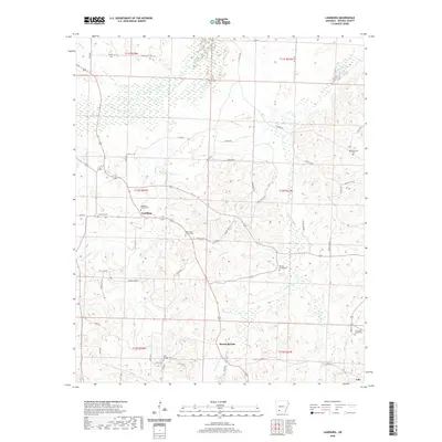
2020 Map of Laneburg
USGS Topo · Published 2020About this map
Laneburg and its surrounding countryside in Nevada County are defined by a network of creeks and small family-oriented community centers. The landscape is carved by the Terre Rouge Creek and Sandy Cr systems, where the geography naturally dictated the location of early settlements and travel routes. Small church-and-cemetery clusters such as New Salem Church Cem and Laneburg Church Cem anchor the social history of the region, reflecting a rural settlement pattern that persists into the 21st century. Further south, Mount Moriah and Cale mark the lower reaches of the quadrangle, with the terrain punctuated by localized landmarks like Serepta Spring and its adjacent Serepta Spring Cemetery. The map captures the continued importance of regional roads, such as Nevada 2000 Road, in connecting these dispersed agricultural and timber-linked communities.
Find a feature on this map
62 named features on this map. Tap any name to fly to it.
Don’t see what you’re looking for? This feature index may not catch every label — zoom into the map to look around manually.
Map Details
Editions of this 2020 Laneburg Map
This is the sole edition of this map. No revisions or reprints were ever made.
Other maps of this area

1901 · Gurdon
USGS Topo · 1:125,000

1953 · El Dorado
USGS Topo · 1:250,000

1957 · El Dorado
USGS Topo · 1:250,000

1958 · El Dorado
USGS Topo · 1:250,000

1960 · El Dorado
USGS Topo · 1:250,000

1970 · Whelen Springs
USGS Topo · 1:24,000

1970 · Prescott East
USGS Topo · 1:24,000
1970 · Prescott West
USGS Topo · 1:24,000
1972 · Gurdon
USGS Topo · 1:62,500
1973 · Bodcaw
USGS Topo · 1:24,000