
1970 Map of Whelen Springs
USGS Topo · Published 1972About this map
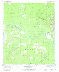
Little Missouri River meanders across this landscape, defining the jagged border between Clark and Nevada counties in southwestern Arkansas. The river valley is a complex network of wetlands and seasonal drainages, characterized by numerous backwater features like Deep Slough, Long Slough, and McNeeley Slough. This 1970 field-checked survey documents a rural economy transitioning from timber and agriculture to active resource extraction, evidenced by the numerous Gravel Pits scattered across the Red Land and Union townships. The local social fabric is clearly visible through a high density of country churches and family cemeteries, including Shady Grove Ch and the Rose Hill Cem. Settlement is concentrated along the Missouri Pacific railroad corridor, which serves the primary communities of Whelen Springs and the smaller siding at Barringer. Rising above the bottomlands, Whetstone Mountain provides a distinct topographical landmark in the eastern portion of the quadrangle.
Find a feature on this map
34 named features on this map. Tap any name to fly to it.
Don’t see what you’re looking for? This feature index may not catch every label — zoom into the map to look around manually.
Map Details
Editions of this 1970 Whelen Springs Map
2 editions found
Other maps of this area

1901 · Gurdon
USGS Topo · 1:125,000

1953 · El Dorado
USGS Topo · 1:250,000

1957 · El Dorado
USGS Topo · 1:250,000

1958 · El Dorado
USGS Topo · 1:250,000

1960 · El Dorado
USGS Topo · 1:250,000

1970 · Prescott East
USGS Topo · 1:24,000

1970 · Reader
USGS Topo · 1:24,000
1970 · Gurdon
USGS Topo · 1:24,000
1970 · Curtis
USGS Topo · 1:24,000
1970 · Okolona South
USGS Topo · 1:24,000