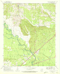
1970 Map of Okolona South
USGS Topo · Published 1972About this map
The Little Missouri River snakes across this landscape, defining the intersection of Clark, Pike, and Nevada counties. This 1970 survey captures the rural character of southwestern Arkansas, where the Missouri Pacific railroad provides a primary transit corridor connecting the settlement of Okolona in the north to Burtsell and Wilson in the south. The area is heavily influenced by the drainage patterns of Terre Noire Creek, Howard Creek, and Black Creek, which feed into the main river channel. Local history and genealogy are well-represented by several country churches, including Maryetta Ch and Missionary Grove Ch, alongside the Old Rome Cem and Okolona Cem. The presence of numerous Gravel Pits along the riverbanks and multiple Pipelines cutting across the terrain indicates a landscape defined by natural resource extraction and mid-century industrial infrastructure.
Find a feature on this map
34 named features on this map. Tap any name to fly to it.
Don’t see what you’re looking for? This feature index may not catch every label — zoom into the map to look around manually.
Map Details
Editions of this 1970 Okolona South Map
This is the sole edition of this map. No revisions or reprints were ever made.
Other maps of this area

1901 · Gurdon
USGS Topo · 1:125,000

1943 · Antoine
USGS Topo · 1:62,500

1953 · El Dorado
USGS Topo · 1:250,000

1955 · Little Rock
USGS Topo · 1:250,000

1956 · Little Rock
USGS Topo · 1:250,000

1957 · El Dorado
USGS Topo · 1:250,000

1958 · El Dorado
USGS Topo · 1:250,000

1960 · El Dorado
USGS Topo · 1:250,000

1960 · Little Rock
USGS Topo · 1:250,000

1964 · Little Rock
USGS Topo · 1:250,000