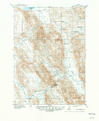
1915 Map of Lanes Creek
USGS Topo · Published 1948About this map
Lanes Grave and the historic Landers Cutoff anchor this 1911-1912 survey of the high mountain valleys in Caribou County. The landscape is defined by a series of parallel northwest-trending ridges, including Rasmussen Ridge and the Wooley Range, which divide fertile ranching grounds like Wooley Valley and Enoch Valley. Early 20th-century settlement is centered around livestock operations, visible in the numerous family landmarks such as Enders Ranch, Stockings Ranch, and Home Ranch.
Find a feature on this map
44 named features on this map. Tap any name to fly to it.
Don’t see what you’re looking for? This feature index may not catch every label — zoom into the map to look around manually.
Map Details
Editions of this 1915 Lanes Creek Map
2 editions found
Other maps of this area

1911 · Slug Creek
USGS Topo · 1:62,500

1914 · Henry
USGS Topo · 1:48,000

1915 · Freedom
USGS Topo · 1:62,500

1915 · Crow Creek
USGS Topo · 1:62,500

1915 · Lanes Creek
USGS Topo · 1:62,500

1916 · Henry
USGS Topo · 1:62,500

1917 · Cranes Flat
USGS Topo · 1:62,500

1932 · Irwin
USGS Topo · 1:96,000

1935 · Irwin
USGS Topo · 1:125,000

1948 · Soda Springs
USGS Topo · 1:62,500