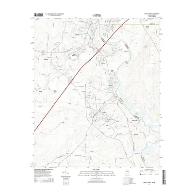
2014 Map of Lanett South
USGS Topo · Published 2014About this map
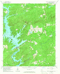
The Chattahoochee River forms the central spine of this 2014 survey, marking the state border between Georgia and Alabama. This corridor is defined by a dense sequence of textile-mill settlements including Shawmut, Langdale, Fairfax, River View, and Glass, which are now consolidated under the city of Valley. The landscape transitions from the developed areas of Lanett and Little Shawmut in the north to the backwaters of Bartletts Ferry Lake in the south. Notable terrain features like the Great Bend and Magnolia Island illustrate the river's winding path through the borderlands of Chambers County and Harris County. Local history is preserved through numerous family and community burial grounds, such as Pine Hill Cem and Oak Wood Cem, while the Lanett Municipal Airport and Fob James Dr reflect the area's modern infrastructure and transportation links.
Find a feature on this map
58 named features on this map. Tap any name to fly to it.
Don’t see what you’re looking for? This feature index may not catch every label — zoom into the map to look around manually.
Map Details
Editions of this 2014 Lanett South Map
This is the sole edition of this map. No revisions or reprints were ever made.
Other maps of this area

1907 · Opelika
USGS Topo · 1:125,000

1909 · Opelika
USGS Topo · 1:125,000

1955 · Phenix City
USGS Topo · 1:250,000

1957 · Phenix City
USGS Topo · 1:250,000

1958 · Phenix City
USGS Topo · 1:250,000
1964 · Whitesville
USGS Topo · 1:24,000
1964 · Cannonville
USGS Topo · 1:24,000
1964 · Lanett North
USGS Topo · 1:24,000

1964 · Lanett South
USGS Topo · 1:24,000
1965 · Bartletts Ferry Dam
USGS Topo · 1:24,000