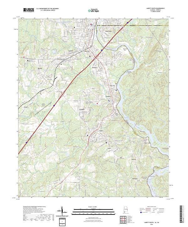
2024 Map of Lanett South
USGS Topo · Published 2024About this map
The Chattahoochee River serves as the central artery and border for this region, winding through a corridor of mill villages and river crossings. These industrial settlements, including Langdale, Shawmut, and Fairfax, illustrate the historical development of the Chattahoochee Valley as a textile manufacturing hub. The map captures the infrastructure supporting these communities, from the Southern Union State Valley Community College to the Lanett Regional Airport near Nelson.
Find a feature on this map
57 named features on this map. Tap any name to fly to it.
Don’t see what you’re looking for? This feature index may not catch every label — zoom into the map to look around manually.
Map Details
Editions of this 2024 Lanett South Map
This is the sole edition of this map. No revisions or reprints were ever made.
Other maps of this area

1907 · Opelika
USGS Topo · 1:125,000

1909 · Opelika
USGS Topo · 1:125,000

1955 · Phenix City
USGS Topo · 1:250,000

1957 · Phenix City
USGS Topo · 1:250,000

1958 · Phenix City
USGS Topo · 1:250,000
1964 · Whitesville
USGS Topo · 1:24,000
1964 · Cannonville
USGS Topo · 1:24,000
1964 · Lanett North
USGS Topo · 1:24,000

1964 · Lanett South
USGS Topo · 1:24,000
1965 · Bartletts Ferry Dam
USGS Topo · 1:24,000