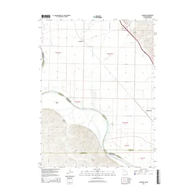
2014 Map of Langdon
USGS Topo · Published 2014About this map
Missouri River watercourses and ancestral burial grounds define this borderland region where Missouri and Nebraska meet. The intricate drainage of the floodplain is evident in the Old Channel Nishnabotna River, State Line Slough, and Nishnabotna Lake, reflecting the shifting nature of these western rivers over time. Small settlements like Langdon and Nishnabotna serve as anchors for the surrounding agricultural tracts, while Morgan Island sits prominently within the river's path. Local heritage is preserved in several rural cemeteries, including Hunter Cemetery and Hillsdale Cemetery in Missouri, and Saint Deroin Cemetery further south. The map provides a precise look at the early 21st-century road network, from local routes like 721 RD to the intersections of Golden Ave and 280th ST, illustrating the intersection of state lines and county boundaries in this river-bend landscape.
Find a feature on this map
37 named features on this map. Tap any name to fly to it.
Don’t see what you’re looking for? This feature index may not catch every label — zoom into the map to look around manually.
Map Details
Editions of this 2014 Langdon Map
This is the sole edition of this map. No revisions or reprints were ever made.
Other maps of this area

1915 · Falls City
USGS Topo · 1:62,500

1915 · Nemaha
USGS Topo · 1:62,500

1920 · Craig
USGS Topo · 1:62,500

1936 · Fairfax
USGS Topo · 1:24,000

1939 · Tarkio
USGS Topo · 1:62,500

1939 · Nemaha
USGS Topo · 1:62,500

1940 · Tarkio
USGS Topo · 1:62,500

1941 · Tarkio
USGS Topo · 1:62,500

1949 · Nemaha
USGS Topo · 1:62,500

1955 · Nebraska City
USGS Topo · 1:250,000