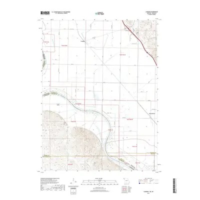
2017 Map of Langdon
USGS Topo · Published 2017About this map
The Missouri River defines the shifting boundary between Missouri and Nebraska in this part of the river valley, where the legacy of hydraulic changes is visible in the Old Channel Nishnabotna River. The small settlements of Langdon and Nishnabotna sit on the fertile plains, surrounded by a grid of rural routes including State Hwy E and State Hwy Z. Local history is anchored by several burial sites, such as Hunter Cem in the northern bluffs and Hillsdale Cem further south. Near the southern edge of the map, Saint Deroin Cem overlooks the river's bend, while Morgan Island sits within the channel. The landscape is a network of drainage features like State Line Slough, Rock Cr, and Beadow Cr, reflecting the complex hydrology of this agricultural borderland.
Find a feature on this map
32 named features on this map. Tap any name to fly to it.
Don’t see what you’re looking for? This feature index may not catch every label — zoom into the map to look around manually.
Map Details
Editions of this 2017 Langdon Map
This is the sole edition of this map. No revisions or reprints were ever made.
Other maps of this area

1915 · Falls City
USGS Topo · 1:62,500

1915 · Nemaha
USGS Topo · 1:62,500

1920 · Craig
USGS Topo · 1:62,500

1936 · Fairfax
USGS Topo · 1:24,000

1939 · Tarkio
USGS Topo · 1:62,500

1939 · Nemaha
USGS Topo · 1:62,500

1940 · Tarkio
USGS Topo · 1:62,500

1941 · Tarkio
USGS Topo · 1:62,500

1949 · Nemaha
USGS Topo · 1:62,500

1955 · Nebraska City
USGS Topo · 1:250,000