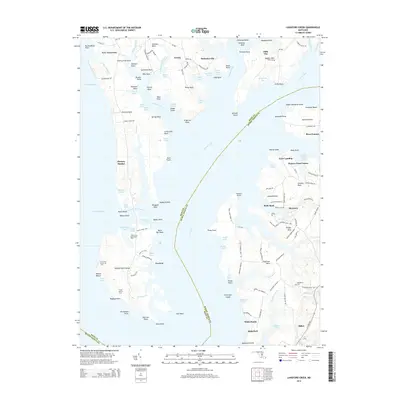
2014 Map of Langford Creek
USGS Topo · Published 2014About this map
Eastern Neck and its intricate network of coves and points dominate this 2014 survey of the Maryland shoreline. The landscape is defined by the meeting of the Chesapeake Bay and the Chester River, where points like Cherry Tree Point and Prussian Point reach into the tidal waters. The map reveals a peninsula shaped by agricultural tracts and small waterfront settlements, such as Cliffs City and New Yarmouth. Inland, the terrain is partitioned by local roads like Skinners Neck Rd and McKinleyville Rd, connecting legacy farming areas such as Pioneer Point Farms to the river's edge.
Find a feature on this map
154 named features on this map. Tap any name to fly to it.
Don’t see what you’re looking for? This feature index may not catch every label — zoom into the map to look around manually.
Map Details
Editions of this 2014 Langford Creek Map
This is the sole edition of this map. No revisions or reprints were ever made.
Other maps of this area

1892 · Annapolis
USGS Topo · 1:62,500

1893 · North Point
USGS Topo · 1:62,500

1898 · Choptank
USGS Topo · 1:125,000

1898 · Tolchester
USGS Topo · 1:125,000

1901 · Chestertown
USGS Topo · 1:62,500

1903 · Tolchester
USGS Topo · 1:125,000

1904 · St. Michaels
USGS Topo · 1:62,500

1904 · North Point
USGS Topo · 1:62,500

1904 · Annapolis
USGS Topo · 1:62,500

1908 · Tolchester
USGS Topo · 1:125,000