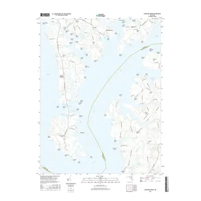
2016 Map of Langford Creek
USGS Topo · Published 2016About this map
Eastern Neck Island and the complex waterways of the Chester River dominate this coastal survey. The landscape is a labyrinth of points and coves, including Prussian Point, Sycamore Point, and Fryingpan Cove, illustrating the deeply indented shoreline of the Maryland Eastern Shore. Small settlements such as Crosby, McKinleyville, and Cliffs City are linked by a network of rural roads like Skinners Neck Rd and Lands End Rd. The map detail highlights the agricultural and maritime character of the region, featuring named farms and landings such as Bogles Wharf Rd. Genealogists may find interest in the Gouldtown Cem or family-named landmarks like Toms Point and Jerrys Cove. The presence of the Duck Inn Trail and Boxes Point Trail suggests a landscape preserved for recreation and conservation amidst the historic neck lands.
Find a feature on this map
135 named features on this map. Tap any name to fly to it.
Don’t see what you’re looking for? This feature index may not catch every label — zoom into the map to look around manually.
Map Details
Editions of this 2016 Langford Creek Map
This is the sole edition of this map. No revisions or reprints were ever made.
Other maps of this area

1892 · Annapolis
USGS Topo · 1:62,500

1893 · North Point
USGS Topo · 1:62,500

1898 · Choptank
USGS Topo · 1:125,000

1898 · Tolchester
USGS Topo · 1:125,000

1901 · Chestertown
USGS Topo · 1:62,500

1903 · Tolchester
USGS Topo · 1:125,000

1904 · St. Michaels
USGS Topo · 1:62,500

1904 · North Point
USGS Topo · 1:62,500

1904 · Annapolis
USGS Topo · 1:62,500

1908 · Tolchester
USGS Topo · 1:125,000