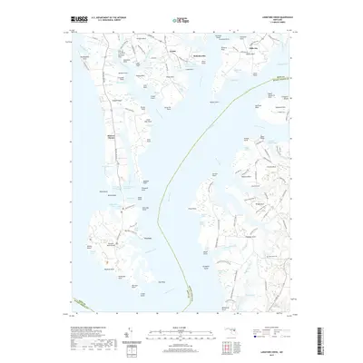
2019 Map of Langford Creek
USGS Topo · Published 2019About this map
Eastern Neck Island and the intricate peninsulas of the upper Chesapeake Bay define this landscape along the boundary of Kent and Queen Anne's counties. The Chester River divides the territory, separating the large wildlife refuge areas to the west from the farming necks to the east. Small communities like Crosby, McKinleyville, and Cliffs City serve as hubs for the surrounding maritime and agricultural lands. The shoreline is exceptionally complex, marked by dozens of named coves and points such as Langfords Bay, Comegys Bight, and Jerrys Cove. On the eastern side of the river, Tilghman Neck and Corsica Neck show a pattern of large estates and farm lanes, including Walnut Grove Farm Ln and Reeds Creek Farm Ln. For family historians, the Gouldtown Cem near Queenstown Creek provides a specific point of genealogical interest in this coastal Maryland setting.
Find a feature on this map
146 named features on this map. Tap any name to fly to it.
Don’t see what you’re looking for? This feature index may not catch every label — zoom into the map to look around manually.
Map Details
Editions of this 2019 Langford Creek Map
This is the sole edition of this map. No revisions or reprints were ever made.
Other maps of this area

1892 · Annapolis
USGS Topo · 1:62,500

1893 · North Point
USGS Topo · 1:62,500

1898 · Choptank
USGS Topo · 1:125,000

1898 · Tolchester
USGS Topo · 1:125,000

1901 · Chestertown
USGS Topo · 1:62,500

1903 · Tolchester
USGS Topo · 1:125,000

1904 · St. Michaels
USGS Topo · 1:62,500

1904 · North Point
USGS Topo · 1:62,500

1904 · Annapolis
USGS Topo · 1:62,500

1908 · Tolchester
USGS Topo · 1:125,000