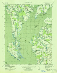
1943 Map of Langford Creek
USGS Topo · Published 1943About this map
Eastern Neck Island and the intricate peninsulas of the Maryland Eastern Shore are captured here during World War II, showing a landscape defined by tidewater access and small farming enclaves. The map detail highlights the importance of the waterfront to local life, with Cliffs Wharf and Earle Landing serving as vital transition points between land and the Corsica River. Inland, the settlement pattern is sparse, focused around community anchors like Raum Chapel, Piney Neck Church, and the Skinners Neck School. This 1942 road data reflects a quiet era for Kent County, where family names like Gouldtown were already etched into the geography. The presence of numerous coves, such as Fryingpan Cove and Burnt House Cove, underscores the drowned-river topography that has long shaped the navigation and commerce of this region.
Find a feature on this map
108 named features on this map. Tap any name to fly to it.
Don’t see what you’re looking for? This feature index may not catch every label — zoom into the map to look around manually.
Map Details
Editions of this 1943 Langford Creek Map
This is the sole edition of this map. No revisions or reprints were ever made.
Other maps of this area

1892 · Annapolis
USGS Topo · 1:62,500

1893 · North Point
USGS Topo · 1:62,500

1898 · Choptank
USGS Topo · 1:125,000

1898 · Tolchester
USGS Topo · 1:125,000

1901 · Chestertown
USGS Topo · 1:62,500

1903 · Tolchester
USGS Topo · 1:125,000

1904 · St. Michaels
USGS Topo · 1:62,500

1904 · North Point
USGS Topo · 1:62,500

1904 · Annapolis
USGS Topo · 1:62,500

1908 · Tolchester
USGS Topo · 1:125,000