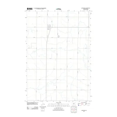
2012 Map of Langford
USGS Topo · Published 2012About this map
Langford serves as the central hub of this Marshall County landscape, showing the organized town grid where Elm St and Linden St intersect the north-south axis of W Front St. The surrounding countryside is defined by the section-line road network and the winding course of Antelope Cr, which meanders across the prairie south of the town site. For those tracing local history or family roots, the map provides precise locations for two distinct burial sites located near the town center: Hillside Cem and Saint Peter Cem. This 2012 survey illustrates the enduring agricultural character of the region, where a dense network of numbered avenues like 418th Ave and streets like 124th St provide access to the expansive fields of the Glacial Lakes region.
Find a feature on this map
22 named features on this map. Tap any name to fly to it.
Don’t see what you’re looking for? This feature index may not catch every label — zoom into the map to look around manually.
Map Details
Editions of this 2012 Langford Map
This is the sole edition of this map. No revisions or reprints were ever made.
Other maps of this area

1953 · Milbank
USGS Topo · 1:250,000

1958 · Milbank
USGS Topo · 1:250,000

1958 · Spain
USGS Topo · 1:24,000

1958 · Britton 4 NW
USGS Topo · 1:24,000

1958 · Britton 4 SW
USGS Topo · 1:24,000
1958 · Amherst
USGS Topo · 1:24,000

1958 · Andover
USGS Topo · 1:24,000

1958 · Langford
USGS Topo · 1:24,000

1958 · Pierpont
USGS Topo · 1:24,000
1958 · Langford SW
USGS Topo · 1:24,000