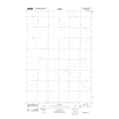
2012 Map of Langford SW
USGS Topo · Published 2012About this map
Augustana Cem sits on a slight rise in the northwestern corner of this agricultural section of Brown County, a quiet landmark amidst the grid of rural roads. This part of South Dakota is defined by its methodical section lines, where 412th Ave and 122nd St intersect to form the basic structure of the local farming landscape. The topography is influenced by the winding course of Antelope Cr, which meanders across the center and eastern portions of the quadrangle. The creek's serpentine path contrasts sharply with the rigid geometry of the surrounding section roads, illustrating how natural drainage patterns continue to dictate the subtle contours of the plains despite the formal imposition of the Public Land Survey System.
Find a feature on this map
17 named features on this map. Tap any name to fly to it.
Don’t see what you’re looking for? This feature index may not catch every label — zoom into the map to look around manually.
Map Details
Editions of this 2012 Langford SW Map
This is the sole edition of this map. No revisions or reprints were ever made.
Other maps of this area

1895 · Aberdeen
USGS Topo · 1:125,000

1896 · Columbia
USGS Topo · 1:125,000

1952 · Huffton
USGS Topo · 1:24,000

1953 · Milbank
USGS Topo · 1:250,000

1954 · Groton
USGS Topo · 1:24,000

1954 · Aberdeen
USGS Topo · 1:250,000

1956 · Aberdeen
USGS Topo · 1:250,000
1956 · Claremont
USGS Topo · 1:24,000

1958 · Milbank
USGS Topo · 1:250,000

1958 · Spain
USGS Topo · 1:24,000