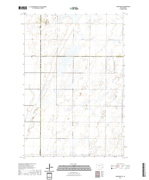
2021 Map of Langford SW
USGS Topo · Published 2021About this map
Augustana Cem sits on a high point overlooking the sprawling wetlands and intermittent drainages that define this corner of the Glacial Lakes region. The landscape is marked by the meeting of three counties—Brown, Marshall, and Day—where the section-line road grid adapts to the natural flow of Antelope Cr. This 2021 survey reveals a territory dominated by prairie potholes and marshy basins, with travel and commerce primarily channeled along routes like Co Hwy 16 and Co Hwy 13. The mapping reflects the enduring agricultural character of the northern South Dakota plains, where small burial grounds like Augustana provide quiet evidence of the area's early homesteading families and rural communities.
Find a feature on this map
28 named features on this map. Tap any name to fly to it.
Don’t see what you’re looking for? This feature index may not catch every label — zoom into the map to look around manually.
Map Details
Editions of this 2021 Langford SW Map
This is the sole edition of this map. No revisions or reprints were ever made.
Other maps of this area

1895 · Aberdeen
USGS Topo · 1:125,000

1896 · Columbia
USGS Topo · 1:125,000

1952 · Huffton
USGS Topo · 1:24,000

1953 · Milbank
USGS Topo · 1:250,000

1954 · Groton
USGS Topo · 1:24,000

1954 · Aberdeen
USGS Topo · 1:250,000

1956 · Aberdeen
USGS Topo · 1:250,000
1956 · Claremont
USGS Topo · 1:24,000

1958 · Milbank
USGS Topo · 1:250,000

1958 · Spain
USGS Topo · 1:24,000