
1973 Map of Langtry
USGS Topo · Published 1975About this map
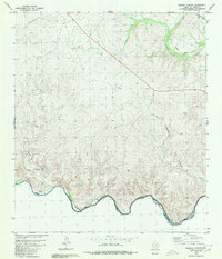
The border community of Langtry sits above a sharp bend in the Rio Grande, appearing here just a few years after the rising waters of the Amistad Reservoir Rio Grande transformed the canyon floor into a complex shoreline. This arid landscape is defined by deep incisions like Eagle Creek Canyon and Rattlesnake Canyon, which drain toward the international boundary. Historically significant transportation corridors are evident in the Old Southern Pacific Railroad Grade, marking the original route through this difficult terrain before modern realignments. Local genealogy and land use are anchored by sites such as the Babb Cem and the Billings Ranch, while the natural limestone geology is highlighted by Emerald Cave and Big Tree Cave north of the settlement. The map documents a moment when federal land management was cementing with the establishment of the Amistad National Recreation Area along the reservoir's edge.
Find a feature on this map
24 named features on this map. Tap any name to fly to it.
Don’t see what you’re looking for? This feature index may not catch every label — zoom into the map to look around manually.
Map Details
Editions of this 1973 Langtry Map
This is the sole edition of this map. No revisions or reprints were ever made.
Other maps of this area

1943 · Langtry
USGS Topo · 1:62,500

1943 · Shumla
USGS Topo · 1:62,500

1944 · Mouth Of Pecos
USGS Topo · 1:62,500

1958 · Del Rio
USGS Topo · 1:250,000

1964 · Del Rio
USGS Topo · 1:250,000
1972 · Zuberbueler Bend NW
USGS Topo · 1:24,000
1973 · Still Canyon
USGS Topo · 1:24,000
1973 · Shumla
USGS Topo · 1:24,000
1973 · Harkell Canyon
USGS Topo · 1:24,000
1980 · Ramsey Canyon
USGS Topo · 1:24,000