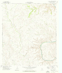
1973 Map of Harkell Canyon
USGS Topo · Published 1976About this map
The Pecos River carves a sharp, deep bend through the limestone plateaus of Val Verde County in this early 1970s survey. The landscape is defined by its complex drainage systems, where Harkell Canyon, Goat Canyon, and Moose Canyon cut narrow paths toward the river. Human presence is sparse and functional, represented by a single Grave on a high ridge and scattered evidence of resource extraction including a Prospect and several Quarries. Transportation is limited to a rugged Jeep Trail that navigates the difficult topography. This map reveals the era's reliance on isolated infrastructure in the West Texas borderlands, marking small but vital water sources like a Well and a Tank that supported the local ranching or mining efforts of the time.
Find a feature on this map
11 named features on this map. Tap any name to fly to it.
Don’t see what you’re looking for? This feature index may not catch every label — zoom into the map to look around manually.
Map Details
Editions of this 1973 Harkell Canyon Map
This is the sole edition of this map. No revisions or reprints were ever made.
Other maps of this area

1943 · Langtry
USGS Topo · 1:62,500

1943 · Shumla
USGS Topo · 1:62,500

1954 · Sonora
USGS Topo · 1:250,000

1958 · Sonora
USGS Topo · 1:250,000

1958 · Del Rio
USGS Topo · 1:250,000

1964 · Del Rio
USGS Topo · 1:250,000

1970 · Everett Canyon
USGS Topo · 1:24,000

1970 · Little Fielder Draw
USGS Topo · 1:24,000

1973 · Langtry
USGS Topo · 1:24,000
1973 · Still Canyon
USGS Topo · 1:24,000