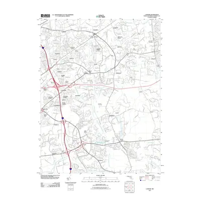
2011 Map of Lanham
USGS Topo · Published 2011About this map
Glenarden and Largo anchor this detailed 2011 survey of the Prince George's County corridor, where suburban expansion meets the winding tributaries of the Western Branch Patuxent River. The landscape is a complex weave of residential developments like Seabrook, Springdale, and Kettering alongside established landmarks. Genealogists will find several burial sites preserved amidst the growth, including Lanham Cemetery, Mount Oak Cemetery, and the Ridley-Zion Cemetery.
Find a feature on this map
71 named features on this map. Tap any name to fly to it.
Don’t see what you’re looking for? This feature index may not catch every label — zoom into the map to look around manually.
Map Details
Editions of this 2011 Lanham Map
This is the sole edition of this map. No revisions or reprints were ever made.
Other maps of this area

1892 · Laurel
USGS Topo · 1:62,500

1892 · Owensville
USGS Topo · 1:62,500

1894 · Laurel
USGS Topo · 1:62,500

1894 · Relay
USGS Topo · 1:62,500

1895 · Owensville
USGS Topo · 1:62,500

1897 · Laurel
USGS Topo · 1:62,500

1899 · Patuxent
USGS Topo · 1:125,000

1900 · Washington
USGS Topo · 1:62,500

1905 · Owensville
USGS Topo · 1:62,500

1906 · Patuxent
USGS Topo · 1:125,000