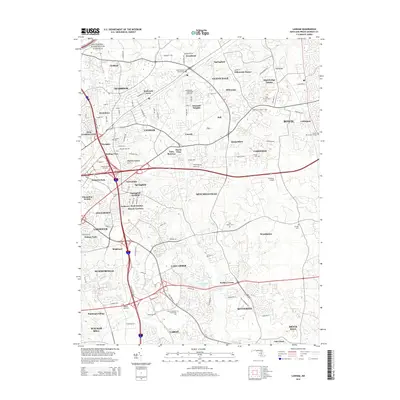
2014 Map of Lanham
USGS Topo · Published 2014About this map
Lanham and the expanding suburbs of Prince George's County are documented here during a period of significant residential and transportation development. The landscape is defined by the heavy infrastructure of the Capital Beltway and the Baltimore - Washington Parkway, which hem in neighborhoods like Seabrook and Glenarden. Despite this modernization, several touchstones of local history remain, including the Saint Georges Chapel Cem and Lanham Cem. The map reveals the transitional character of the area, where institutional sites like the Prince George's Community Coll and recreational landmarks like the Vista Raceway and Freeway Airport sit among dozens of established subdivisions. Genealogists can find numerous family-named landmarks and smaller cemeteries such as Mt Oak Cem and Ridley Zion Cem, providing a detailed look at the local fabric before further late-century growth.
Find a feature on this map
64 named features on this map. Tap any name to fly to it.
Don’t see what you’re looking for? This feature index may not catch every label — zoom into the map to look around manually.
Map Details
Editions of this 2014 Lanham Map
This is the sole edition of this map. No revisions or reprints were ever made.
Other maps of this area

1892 · Laurel
USGS Topo · 1:62,500

1892 · Owensville
USGS Topo · 1:62,500

1894 · Laurel
USGS Topo · 1:62,500

1894 · Relay
USGS Topo · 1:62,500

1895 · Owensville
USGS Topo · 1:62,500

1897 · Laurel
USGS Topo · 1:62,500

1899 · Patuxent
USGS Topo · 1:125,000

1900 · Washington
USGS Topo · 1:62,500

1905 · Owensville
USGS Topo · 1:62,500

1906 · Patuxent
USGS Topo · 1:125,000